Vietnam stretches more than 1,600 kilometers from north to south, and its landscapes and climate shift dramatically along the way. The north holds Hanoi's dense old quarter and the limestone karsts of Ninh Binh; the center offers the imperial city of Hue and the preserved lantern town of Hoi An; the south brings the cool highland air of Da Lat and the energy of Ho Chi Minh City. Coastlines, rice terraces, French colonial architecture and frenetic street life provide constant material for photographers. Because the country spans several climate zones, timing a trip means tracking which regions are in their dry season.
The atmospheric capital of narrow old streets, lakes and faded colonial grandeur.
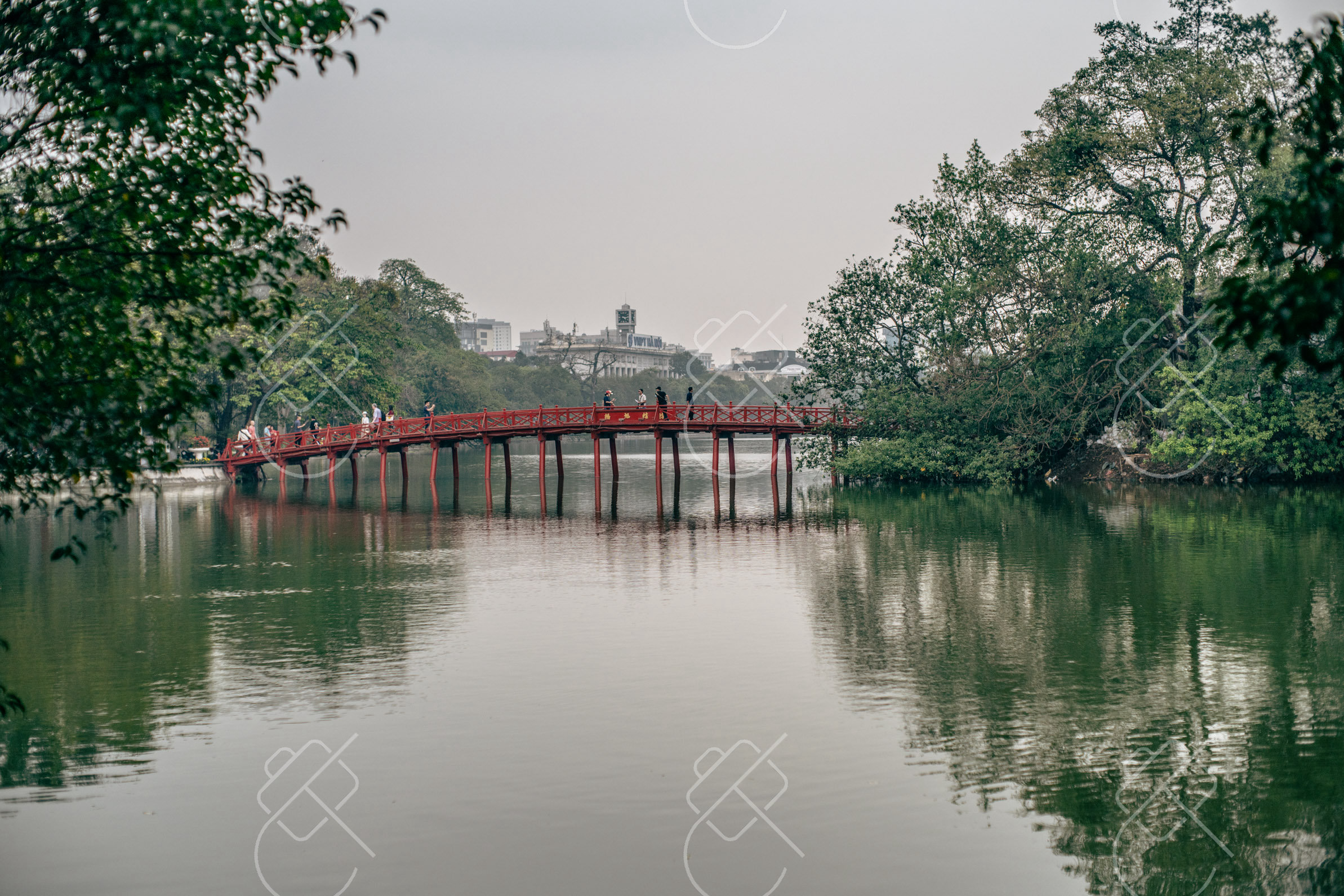
Hanoi, Vietnam's capital, is among the oldest continuously inhabited cities in Southeast Asia and wears its layered history openly. The Old Quarter is a dense tangle of narrow streets, each historically dedicated to a single trade, alive with motorbikes, street vendors and tube houses. Tree-lined boulevards and ochre French colonial buildings give parts of the city a faded European air.
Lakes punctuate the urban fabric, with Hoan Kiem Lake and its small red bridge forming the symbolic heart of the city. Street food culture is central to daily life, eaten on low plastic stools along the pavements. The pace, density and constant motion of the Old Quarter make it especially rewarding for street photography, particularly in early morning and after dark.
When to go: October to April brings cooler, drier weather; autumn (September–November) is especially pleasant, while summer is hot, humid, and prone to heavy rain.
Where to stay: Stay in or beside the Old Quarter near Hoan Kiem Lake to reach the markets, street food and sights on foot.
What to eat: Pho noodle soup, bun cha (grilled pork with noodles) and egg coffee, a Hanoi specialty.
Tip: Explore the Old Quarter on foot in the early morning when markets are active and the streets are cooler and quieter.
Explore Hanoi →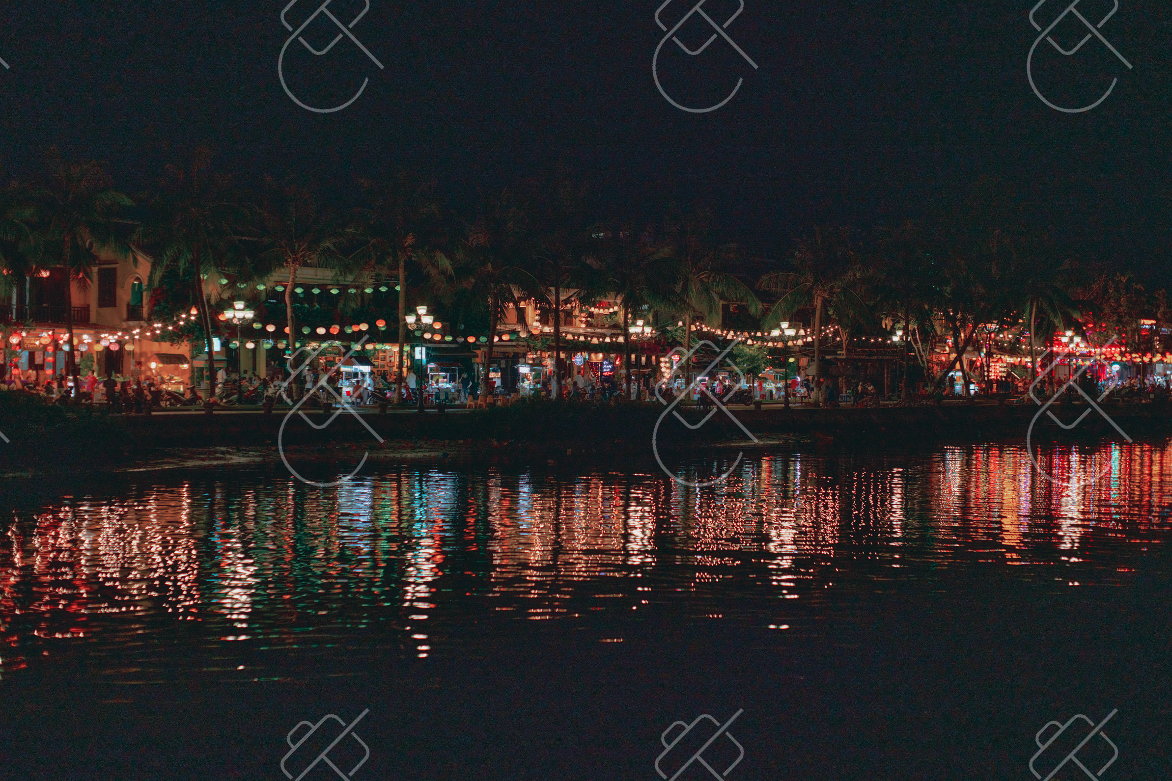
A preserved trading port glowing with silk lanterns along a riverside old town.
Hoi An was a major Southeast Asian trading port between the 15th and 19th centuries, and its remarkably intact old town is a UNESCO World Heritage Site. The architecture blends Vietnamese, Chinese, Japanese and European influences in a compact, vehicle-free riverside core of wooden shophouses, assembly halls and a famous covered bridge. Much of it is painted a distinctive weathered yellow.
The town is defined visually by silk lanterns, which fill the streets and reflect in the Thu Bon River after dark, especially during the monthly full-moon lantern festival when electric lights are dimmed. Nearby beaches and surrounding rice paddies add variety. The pedestrian old town is best photographed at dawn before crowds and again at dusk when the lanterns glow.
When to go: February to April offers warm, dry weather and calm conditions; avoid October and November when flooding can affect the riverside old town.
Where to stay: Stay in or just outside the old town for the lanterns, or near An Bang Beach for a quieter base with easy access.
What to eat: Cao lau (regional pork noodles), white rose dumplings and banh mi from the town's renowned sandwich stalls.
Tip: Photograph the old town and covered bridge at dawn to avoid crowds, then return at dusk for the lanterns reflecting in the river.
Explore Hoi An →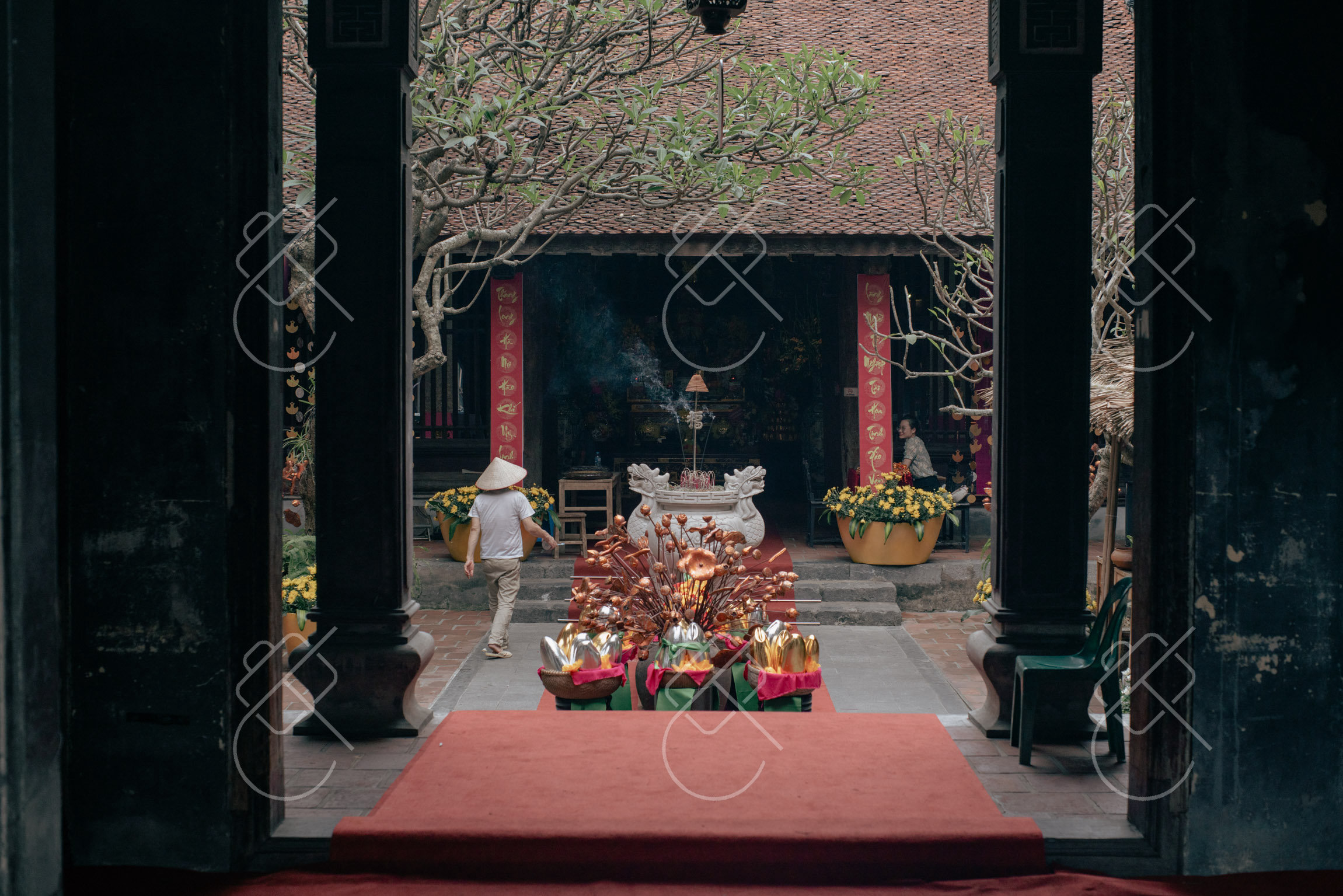
An inland landscape of towering limestone karsts rising from rivers and rice fields.
Ninh Binh province, south of Hanoi, is often described as an inland version of Halong Bay, where dramatic limestone karsts rise sheer from flooded rice paddies and slow rivers. The Trang An landscape complex is a UNESCO World Heritage Site combining the karst scenery with caves, temples and historical sites of Vietnam's ancient capital. The region is easily reached as a day trip or overnight from Hanoi.
Visitors explore the waterways by small rowing boats that thread between the cliffs and through low river caves, a quintessential image of the area. Viewpoints such as the climb at Hang Mua offer sweeping panoramas over the karsts and the winding Ngo Dong River. Rice fields turn vivid green and then gold across the growing season, changing the landscape's palette.
When to go: Visit late May to early June when the rice paddies turn golden, or come in the dry season (January–March) for comfortable boat trips and clear skies.
Where to stay: Stay in the Tam Coc area among the rice fields and karsts for the best access to boat trips and viewpoints.
What to eat: Goat meat (de nui), a local specialty, and com chay (crispy scorched rice).
Tip: Climb Hang Mua early to beat the heat and crowds and catch soft light over the karst-studded river bends.
Explore Ninh Binh →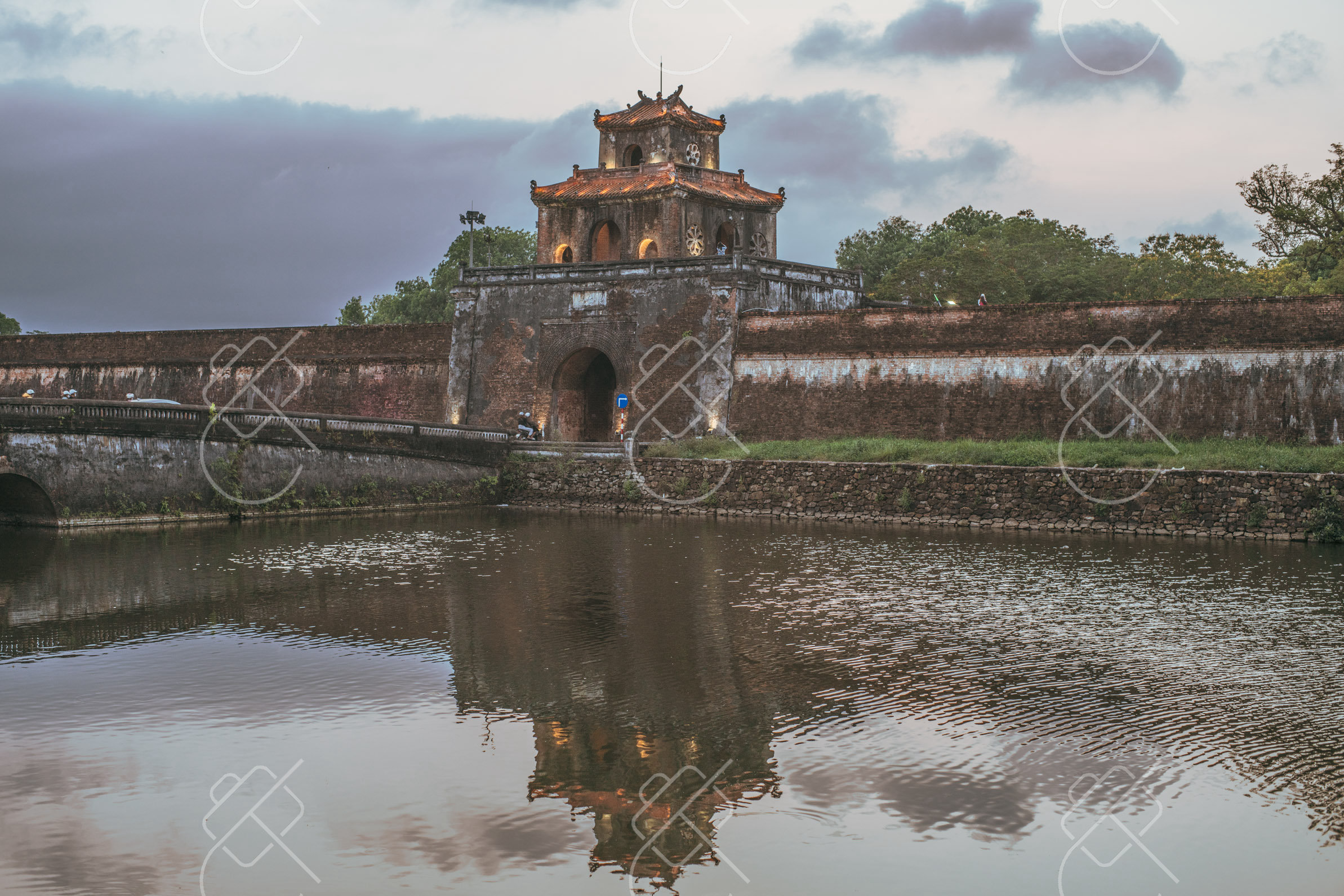
The former imperial capital, home to a walled citadel and riverside royal tombs.
Hue was the capital of Vietnam under the Nguyen dynasty from 1802 to 1945 and remains the country's foremost repository of imperial heritage. Its centerpiece is a vast walled and moated Citadel containing the Imperial City, a UNESCO World Heritage Site modeled in part on the Forbidden City. Much was damaged in 20th-century conflict but extensive restoration continues.
The Perfume River runs through the city, lined with pagodas and leading to the elaborate tombs of the Nguyen emperors set in landscaped grounds outside town. Hue has a more measured, refined atmosphere than Vietnam's larger cities, and its cuisine is distinctively royal and varied. Mist and the river's reflections lend a soft, atmospheric quality to many of its monuments.
When to go: February to April is the driest and most comfortable time; avoid the heavy rains and flooding common from September through December.
Where to stay: Stay along the south bank of the Perfume River near the city center for access to the citadel and boat trips.
What to eat: Bun bo Hue (spicy beef noodle soup) and an array of intricate royal-style small dishes.
Tip: Visit the Imperial City early in the day and combine the riverside royal tombs into a single boat or scooter circuit.
Explore Hue →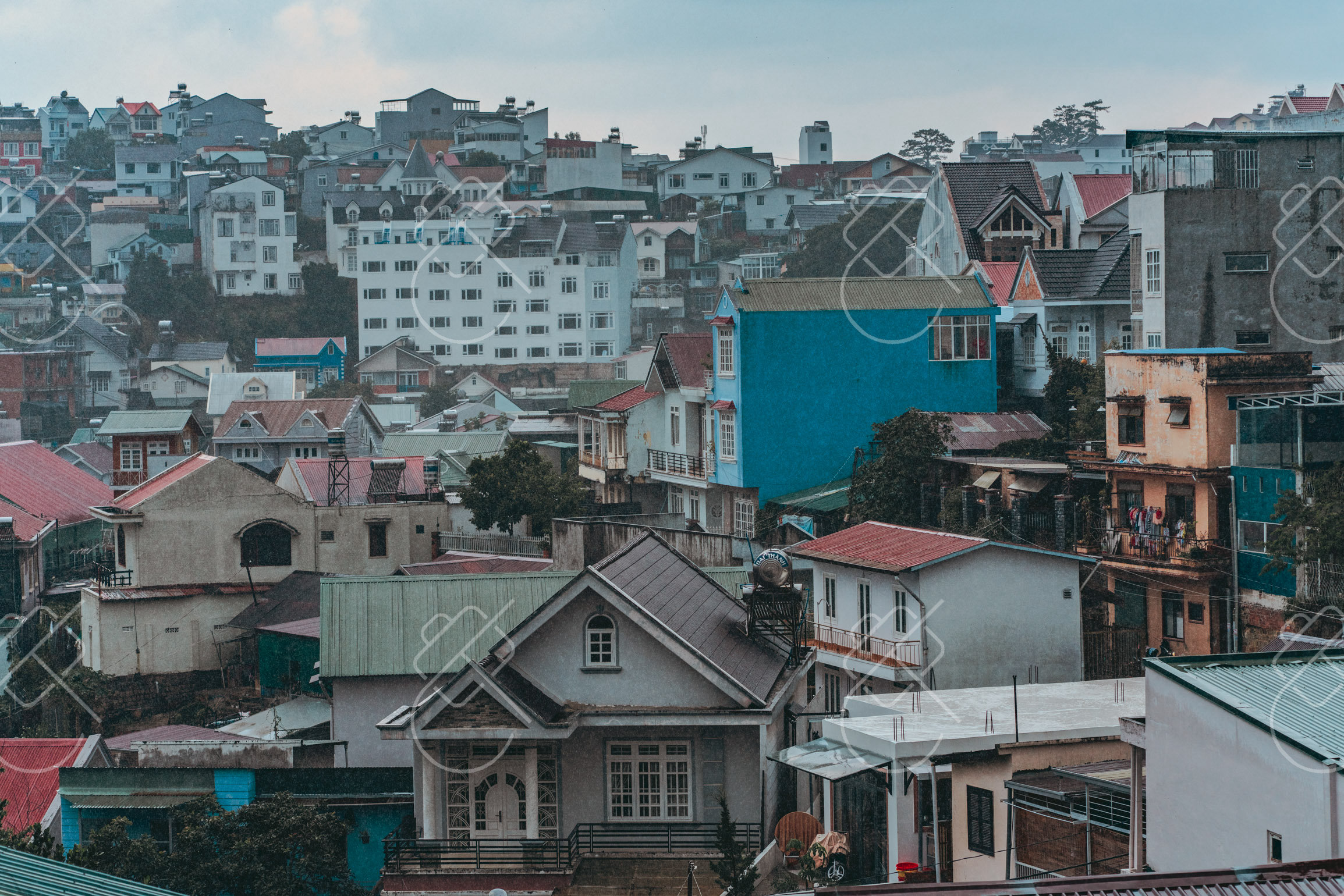
A cool highland retreat of pine forests, flower farms and French villas.
Da Lat sits at around 1,500 meters in the Central Highlands, where its elevation gives it a temperate, spring-like climate that contrasts sharply with the tropical lowlands. Developed by the French as a hill station, it retains colonial villas, a notable train station and a lakeside center surrounded by pine-clad hills. The cool air made it a longtime escape from the coastal heat.
The surrounding region is intensively cultivated with flower farms, vegetable greenhouses and coffee and strawberry plantations, and waterfalls tumble through the hills nearby. Da Lat has also developed a quirky reputation for offbeat architecture and themed attractions. Morning fog drifting over the valleys and lakes gives the highland landscape an ethereal quality for photography.
When to go: This cool highland city is pleasant year-round; the dry season (December–March) is best for flowers and clear weather, avoiding the rainy summer months.
Where to stay: Stay near Xuan Huong Lake and the central market for walkable access to the colonial core and tour departures.
What to eat: Local strawberries and artichoke tea, plus street snacks like banh trang nuong, a grilled rice-paper 'pizza'.
Tip: Set out at dawn to catch fog rolling over the valleys and lakes, the highlands' most atmospheric photographic conditions.
Explore Da Lat →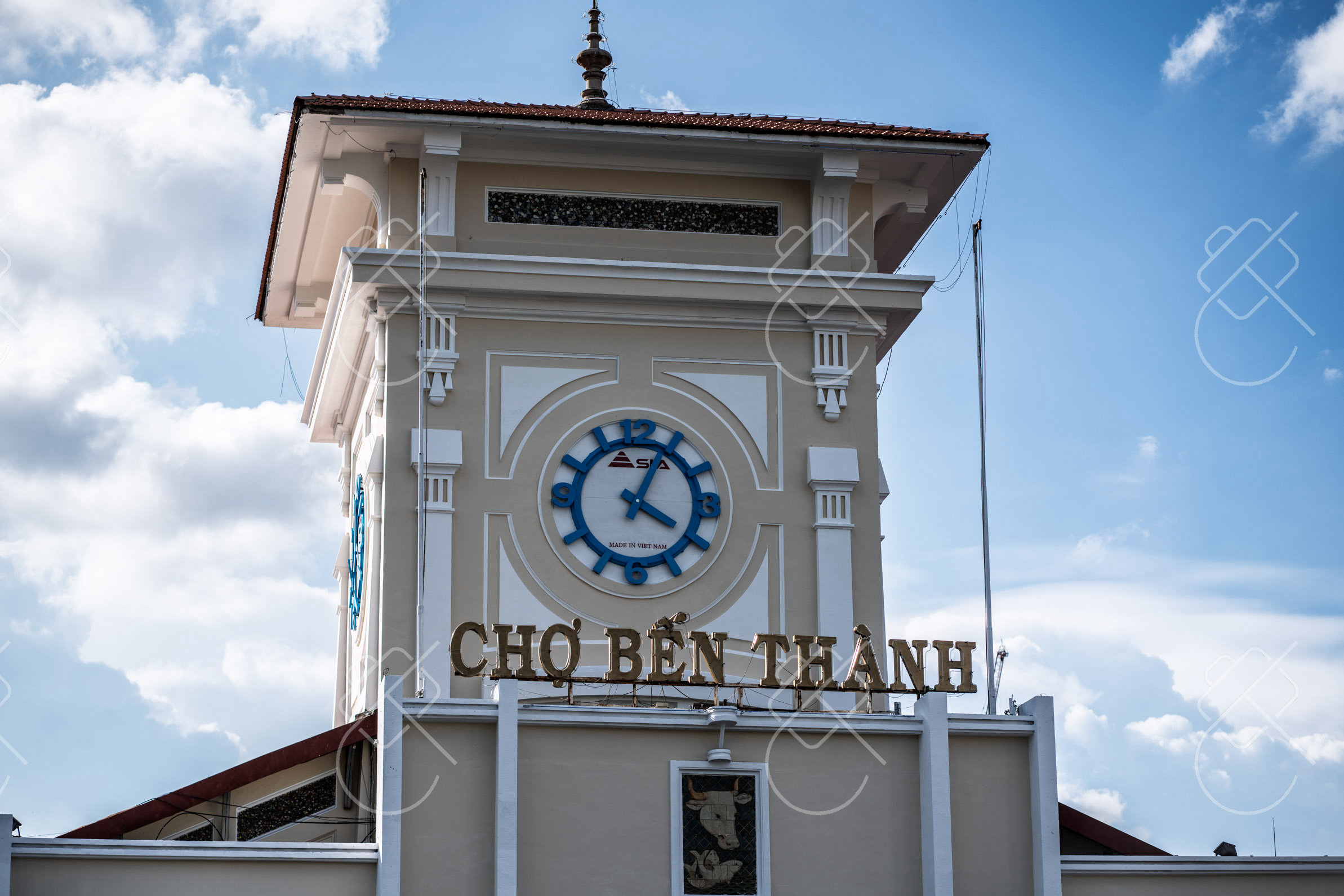
The country's largest, fastest city, blending colonial landmarks and frenetic streets.
Ho Chi Minh City, still widely called Saigon, is Vietnam's largest and most economically dynamic city, a sprawling southern metropolis of relentless energy. Its central District 1 mixes grand French colonial landmarks, such as the Notre-Dame Cathedral and Central Post Office, with rising glass towers and dense, motorbike-choked streets. The pace and scale dwarf the rest of the country.
The city carries weighty modern history, recorded at the War Remnants Museum and the nearby Cu Chi tunnels. Street markets, rooftop bars overlooking the Saigon River and round-the-clock street food define daily life. The constant flow of traffic, neon and commerce makes the city a strong subject for energetic urban and street photography, especially after dark.
When to go: December to April is the dry season with warm, sunny days; the wet season (May–November) brings short, heavy afternoon downpours but fewer crowds.
Where to stay: Stay in central District 1 for proximity to the colonial landmarks, markets, rooftop bars and nightlife.
What to eat: Banh mi, com tam (broken rice with grilled pork) and southern-style street food across the markets.
Tip: Shoot the motorbike traffic and neon after dark from a District 1 rooftop bar for the city's signature energy.
Explore Ho Chi Minh City →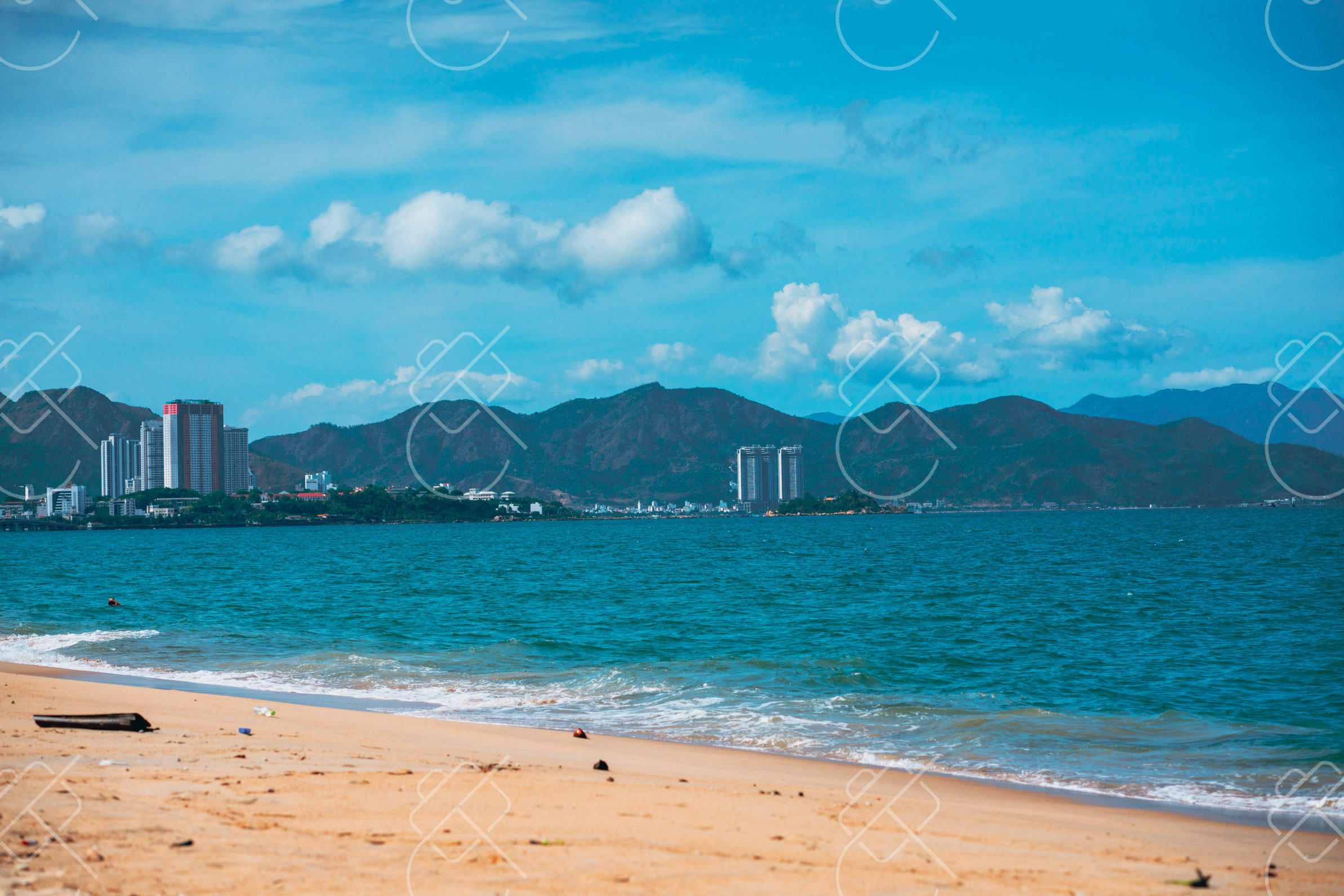
A coastal resort city with a long beach, offshore islands and ancient Cham towers.
Nha Trang is a major coastal resort city on the south-central coast, known for a long crescent of beach backed by a high-rise promenade and a sheltered bay dotted with islands. It is one of Vietnam's most established seaside destinations, popular for swimming, diving and island-hopping boat trips out into the clear waters of the bay.
Beyond the beach, the hilltop Po Nagar Cham Towers, dating from around the 8th to 11th centuries, recall the ancient Champa civilization that once ruled the coast. Mud baths, offshore reefs and viewpoints over the bay round out the area. Sunrise over the sea and the curve of the bay from elevated points are the most rewarding photographic moments.
When to go: January to August offers the driest beach weather and calm seas; avoid October and November when the rainy season brings frequent storms.
Where to stay: Stay along the beachfront promenade for sea access and proximity to the island boat-trip departure points.
What to eat: Fresh seafood, nem nuong (grilled pork rolls) wrapped at the table and bun ca fish noodle soup.
Tip: Climb to the Po Nagar towers or a hilltop pagoda for elevated views over the curving bay and offshore islands.
Explore Nha Trang →See every destination from the 526-day journey:
Browse all destinationsCurious about the gear behind these photos? See the gear list.