The eastern shore of the Adriatic strings together three countries that share a sea but little else. Croatia is the polished, much-photographed front: Venetian-walled towns, terracotta roofs and islands by the thousand. Montenegro compresses an entire landscape into a small space, where a flooded bay coils between limestone walls and the coast rises almost vertically to the Black Mountain that gives the country its name. Albania, long closed to outsiders, opens onto the least-developed Adriatic and Ionian beaches in Europe, backed by Ottoman-era stone towns and a mountainous interior. The further south a traveler goes, the quieter, cheaper and more untamed the coast becomes — a gradient that rewards photographers willing to keep driving.
Croatia's coast runs more than 1,700 kilometers along the Adriatic and is fringed by over a thousand islands, with the Dalmatian cities of Dubrovnik, Split and Zadar built largely from pale local limestone. Inland, the country shifts to lakes, waterfalls and forest, most famously at Plitvice. The light is hard and clear for much of the year, favoring strong shadows and the contrast of orange roof tiles against blue water.
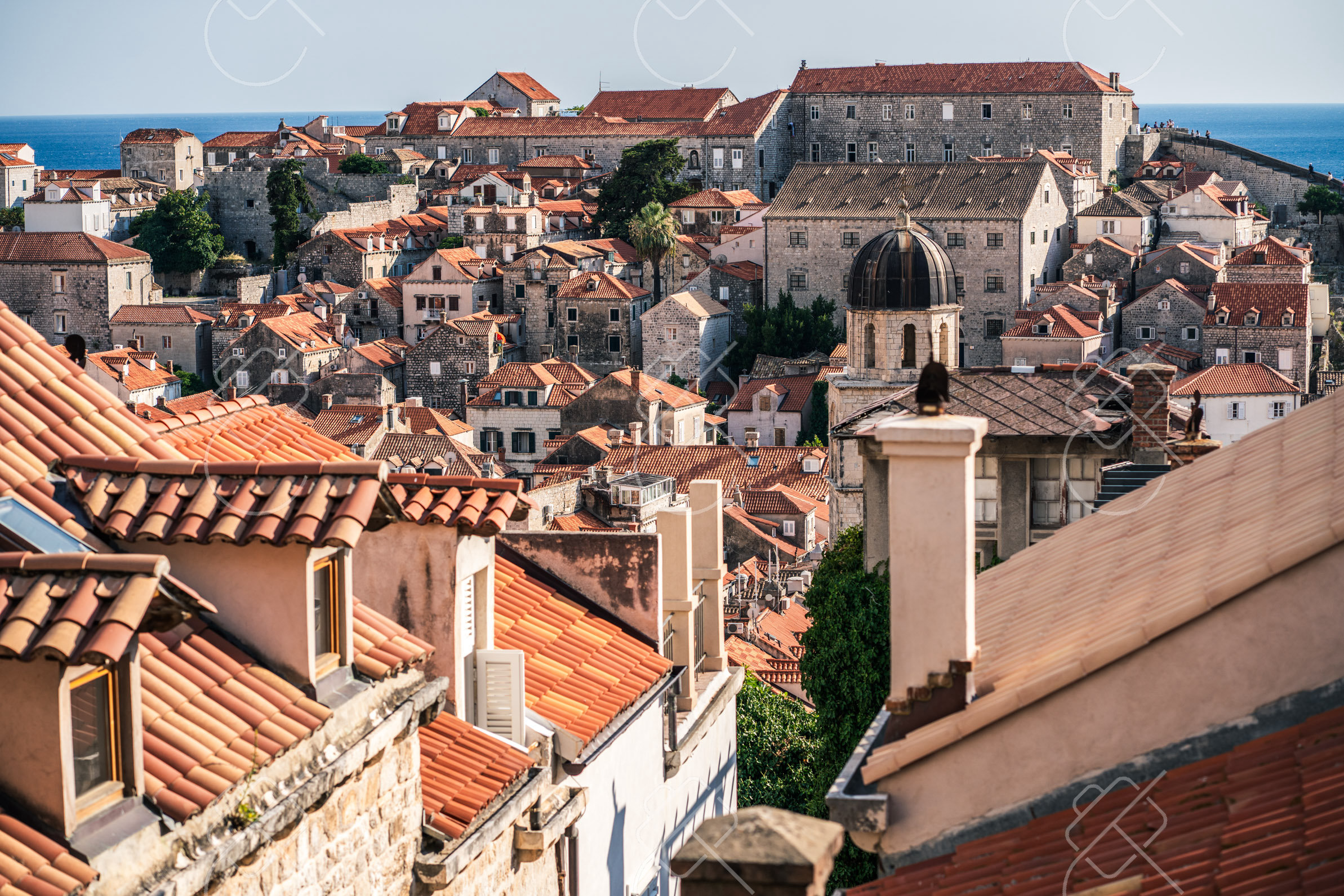
Dalmatia holds Croatia's most recognizable images. Dubrovnik's old town is ringed by intact medieval walls roughly two kilometers in circumference, best photographed from the walls themselves or from the Mount Srd cable car at dusk, when the limestone glows and the sea darkens behind it. Split is built into the ruins of the Diocletian's Palace, a Roman imperial complex from around 300 AD whose stone halls now hold cafes, apartments and a cathedral. North along the coast, Zadar and Sibenik offer smaller, less crowded old towns, and the ferry ports give access to islands such as Hvar, Korcula and Vis.
The interior is a different subject entirely. Plitvice Lakes National Park, a UNESCO World Heritage Site, is a chain of sixteen terraced lakes linked by waterfalls and travertine barriers, threaded with wooden boardwalks that put a photographer directly above turquoise water. Krka National Park, nearer the coast, centers on broad, walkable falls. Both parks are heavily visited in summer; arriving at opening time is the main strategy for clean compositions without crowds.
When to go: May–June and September deliver warm weather, swimmable seas, and lighter crowds than the August rush, with summer festivals along the coast; shoulder seasons offer the best balance of value and pleasant days.
Where to stay: Base in Split for the best balance of an atmospheric old core, ferry connections to the islands, and easy reach of Krka and the Dalmatian coast without Dubrovnik's prices.
What to eat: Dalmatian cooking leans on the sea and the grill: black risotto colored with cuttlefish ink, fresh grilled fish sold by weight, and peka, meat or octopus slow-cooked under a bell-shaped lid covered in embers.
Tip: The midday Adriatic sun is harsh and flattening on white stone; the walls and old towns photograph best in the first and last hour of light, when the limestone turns warm and the shadows give the streets depth.
Explore Croatia →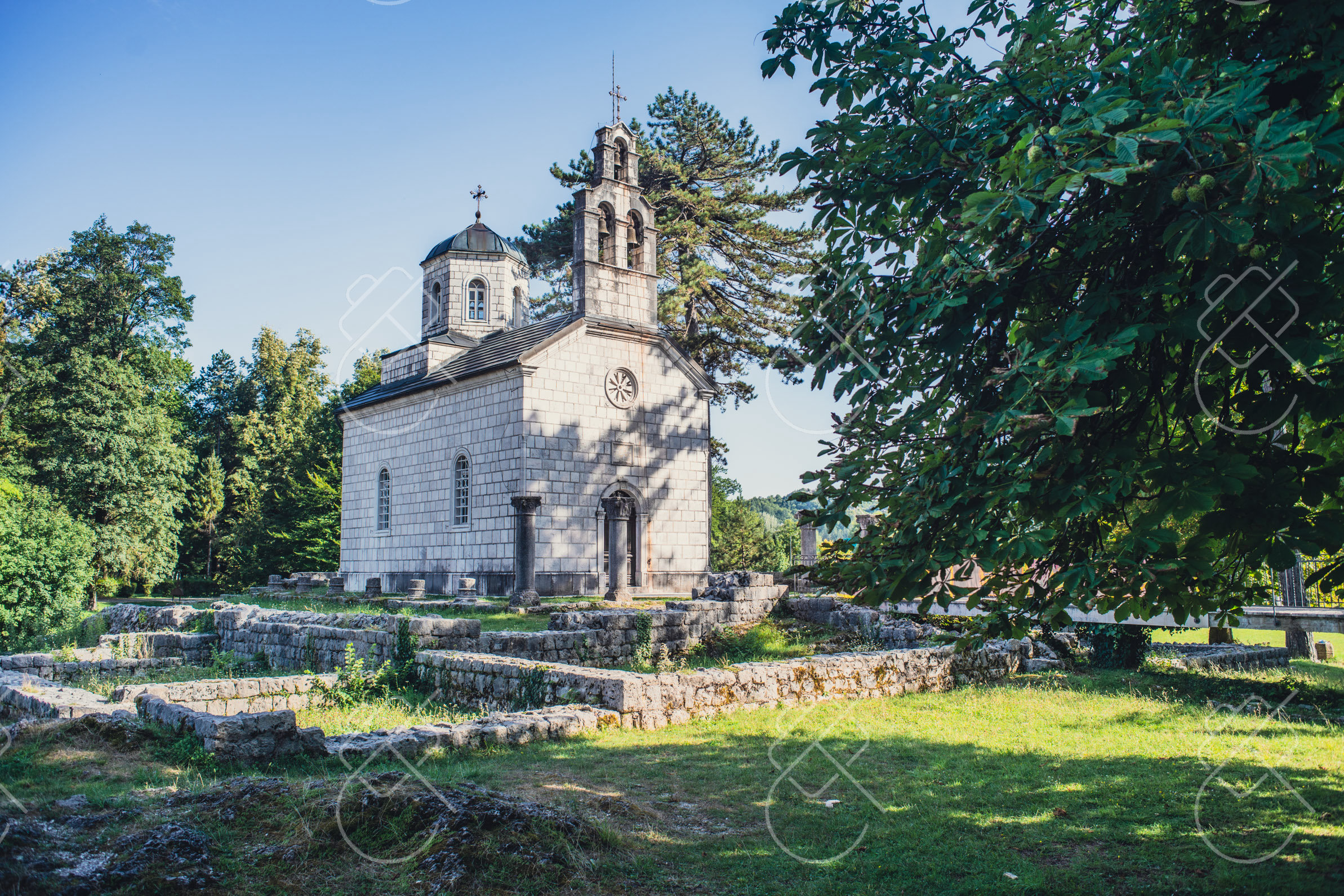
Montenegro packs dramatic range into one of Europe's smaller countries. The Bay of Kotor, a deep, twisting inlet often likened to a fjord, sits beneath sheer limestone walls, while the interior climbs to the peaks of Durmitor and the canyon of the Tara River. The medieval town of Kotor and the rebuilt island of Sveti Stefan are the coast's signature subjects.
The Bay of Kotor is the country's defining landscape: a sequence of linked basins ringed by mountains that rise straight from the water, dotted with stone villages such as Perast and the two small islets offshore, including the man-made Our Lady of the Rocks. The walled town of Kotor sits at the bay's innermost point, and a fortification trail climbs the slope behind it to the fortress of San Giovanni — a steep ascent rewarded with the classic aerial view down the serpentine bay, strongest in early morning before the cruise crowds and the midday haze.
Inland, Montenegro becomes alpine. Durmitor National Park holds glacial lakes, beech forest and high limestone peaks, while the nearby Tara River Canyon is among the deepest gorges in the world and is spanned by the photogenic Djurdjevica Tara Bridge. On the coast itself, Sveti Stefan — a fortified islet of stone houses connected to the mainland by a narrow causeway — is one of the Adriatic's most reproduced views, best shot from the road above to the south.
When to go: June and September are ideal for the coast's warm waters with fewer tourists than peak summer, while spring and autumn suit hiking Durmitor and the northern mountains in mild conditions.
Where to stay: Stay in or just outside Kotor's old town for direct access to the walls, the fortress climb and boat trips around the bay; Perast offers a quieter, more scenic waterfront base nearby.
What to eat: The coast favors grilled fish and Adriatic seafood, while the mountainous interior is known for njeguski prsut, a smoke-dried ham from the village of Njegusi, and hearty cheeses and lamb.
Tip: Climb the Kotor fortress trail at first light. The bay faces in a way that fills with haze and harsh contrast by late morning, and the cruise ships that dock below crowd the lower town from mid-morning onward.
Explore Montenegro →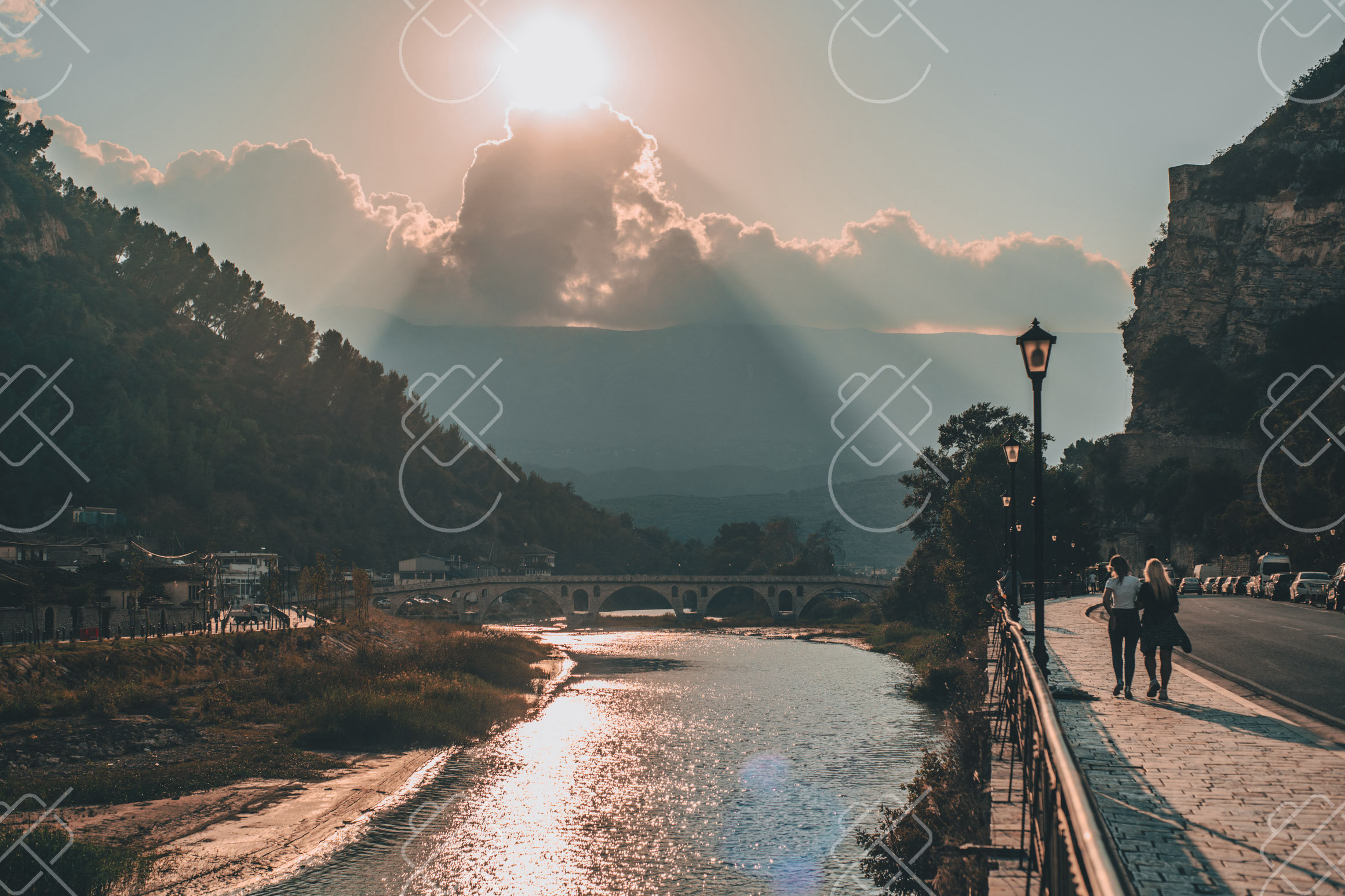
Albania is the least-developed stretch of the eastern Adriatic and Ionian coast, where the Albanian Riviera's beaches sit below bare mountains and prices remain low. Inland, the UNESCO-listed Ottoman stone towns of Berat and Gjirokaster preserve tiered houses climbing their hillsides, and the country is dotted with concrete bunkers from its decades of isolation under communist rule.
The southern coast, known as the Albanian Riviera, runs from the Llogara Pass down to Saranda, with the road descending through switchbacks to a string of villages and clear-water beaches such as Dhermi, Himare and Jale. It remains far quieter and less built-up than the coasts to the north in Croatia and Montenegro. Near Saranda lies Butrint, an ancient site layered with Greek, Roman, Byzantine and Venetian ruins set among wetlands, and the Blue Eye, a deep karst spring of intensely blue water.
Albania's interior holds its two most photographed towns. Berat, the 'city of a thousand windows,' rises in tiers of white Ottoman houses whose rows of windows face the river, beneath a still-inhabited hilltop castle. Gjirokaster is a steeper stone town of slate-roofed houses and a large fortress overlooking the Drino valley. Both are UNESCO World Heritage Sites and reward photographers who climb above the rooftops in the late afternoon.
When to go: June and September offer warm Riviera beaches and clear seas with better value than crowded August, while spring and autumn are perfect for exploring Berat, Gjirokastër, and the Albanian Alps.
Where to stay: Saranda makes a convenient southern base for the Riviera, Butrint and the Blue Eye; for the inland towns, staying in a restored Ottoman guesthouse in Berat or Gjirokaster puts the historic quarters at the doorstep.
What to eat: Albanian food blends Mediterranean and Ottoman influences: byrek, a flaky filled pastry; tave kosi, baked lamb with yogurt; fresh grilled fish on the coast; and abundant olives, feta-like cheese and produce.
Tip: Roads through the mountains and along the Riviera are winding and slow, so distances take longer than they look on a map; planning for fewer kilometers per day leaves time to shoot the stone towns in good evening light.
Explore Albania →See every destination from the 526-day journey:
Browse all destinationsCurious about the gear behind these photos? See the gear list.