New Zealand's South Island is one of the most concentrated landscapes on Earth, packing fiords, glaciers, turquoise lakes and braided rivers into a space smaller than the United Kingdom. The Southern Alps run almost the length of the island, feeding glacier-fed lakes whose rock-flour particles give them an electric blue, while the sparsely populated interior holds some of the darkest night skies anywhere. Seasons are reversed from the Northern Hemisphere, weather changes fast, and the clarity of the air after rain is exceptional.
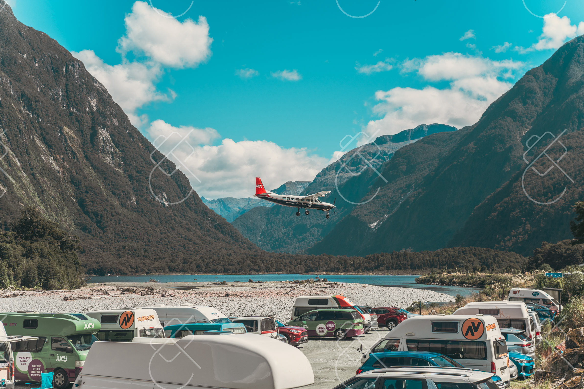
Milford Sound, in Fiordland National Park, is a glacier-carved fiord where sheer cliffs rise more than a kilometer straight from dark water. Among the wettest inhabited places on Earth, its frequent rain feeds hundreds of temporary waterfalls that pour from the cliffs.
Despite its name, Milford Sound is technically a fiord, gouged by glaciers and flooded by the sea. Mitre Peak, rising 1,692 meters almost directly from the water, is its defining landmark and one of the most photographed mountains in the country. The fiord lies within Te Wahipounamu, a UNESCO World Heritage area, and is reached by a single road from Te Anau that itself passes alpine valleys, the Mirror Lakes and the Homer Tunnel.
Rainfall here exceeds six meters a year, and the rain is part of the spectacle: after a downpour, the cliffs run with hundreds of cascades. Permanent falls such as Stirling and Bowen drop directly into the fiord. Boat cruises and kayaks reach the open sea, where fur seals, dolphins and penguins are sometimes seen, and morning often brings still water and mist clinging to the peaks.
When to go: Summer (December–February) brings the warmest weather and long days, while rainy periods unleash dramatic waterfalls; winter is quieter with snow-capped peaks.
Where to stay: Te Anau is the practical base for visiting Milford Sound, about two hours by road, with limited lodge accommodation closer to the fiord itself.
What to eat: Te Anau, the nearest town, serves the day-trip crowd; fresh Fiordland crayfish and South Island lamb feature on regional menus.
Tip: Rain is the norm rather than the exception, so weatherproof gear is essential; the cliffs are at their most dramatic with waterfalls running mid-storm or just after.
Explore Milford Sound →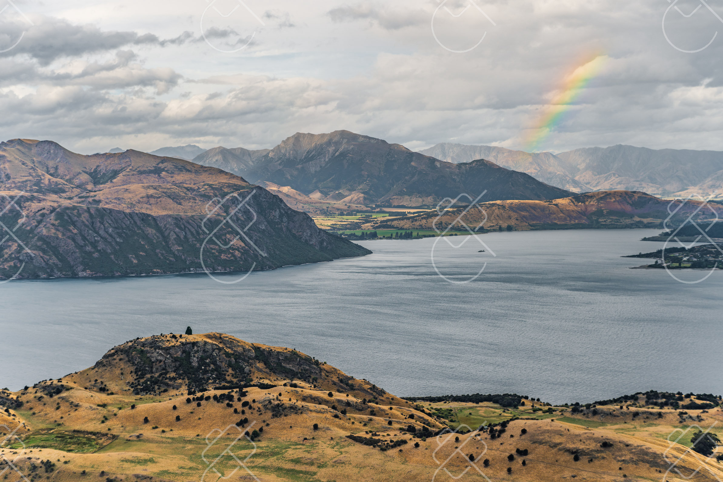
Wanaka is a lakeside town on the shore of Lake Wanaka, surrounded by the peaks of Mount Aspiring National Park. Quieter than nearby Queenstown, it is a base for alpine walks and is known for a single lone willow tree standing in the lake.
The town sits at the southern end of Lake Wanaka, with the snow-capped mountains of Mount Aspiring National Park rising beyond. The most famous photographic subject is #ThatWanakaTree, a lone crack willow growing in the shallows of the lake that has become one of the most recognizable images in New Zealand, especially when its bare winter branches catch sunrise or sunset.
Above the town, the Roys Peak track climbs steeply to a ridge with a sweeping view over the lake and its islands, a viewpoint that draws hikers for sunrise. The surrounding region is dry and golden in summer, snow-covered in winter, and the clear air of the interior makes for exceptionally sharp light. The drive over the Crown Range to Queenstown is among the highest sealed roads in the country.
When to go: Summer (December–March) is ideal for hiking and lake swimming; visit in autumn for golden foliage or winter (July–August) for nearby skiing.
Where to stay: Staying in Wanaka town puts the lakefront, the willow tree and the Roys Peak trailhead all within a short drive.
What to eat: South Island lamb, locally grown stone fruit from the Central Otago orchards, and craft beer from the region's breweries.
Tip: The lone willow is reachable from shore in low water and surrounded by it when the lake is high; arriving before dawn secures a clear foreground for sunrise.
Explore Wanaka →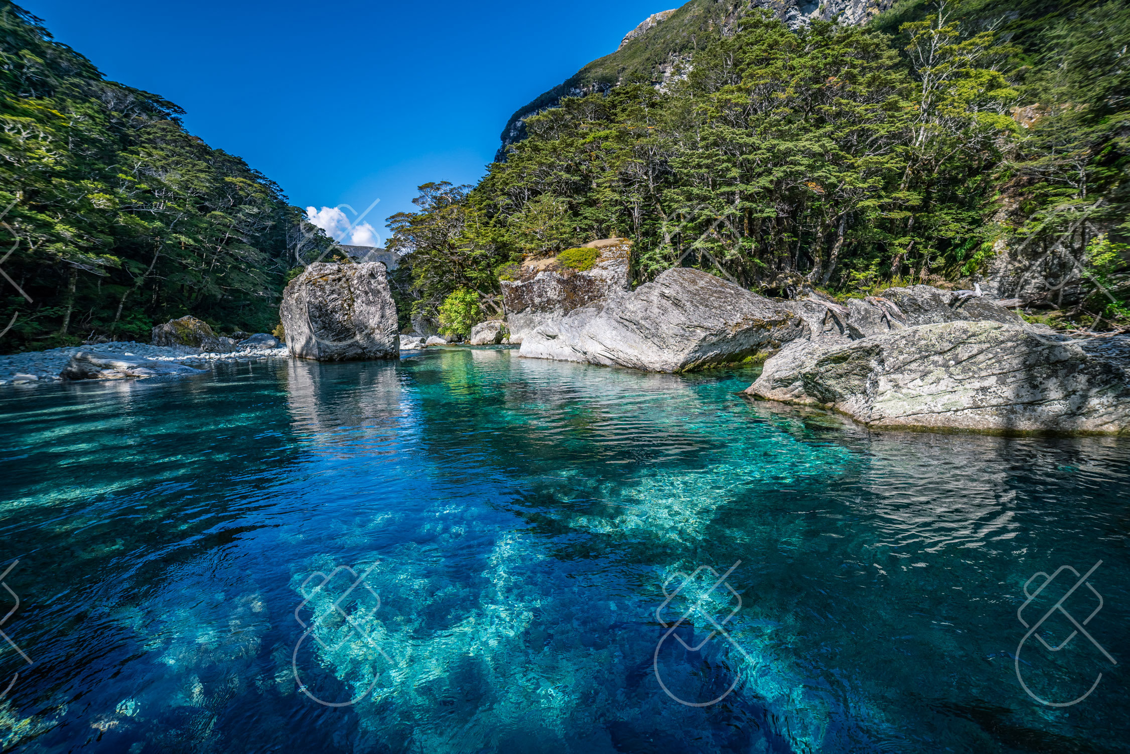
Glenorchy is a small settlement at the head of Lake Wakatipu, about 45 minutes from Queenstown along a scenic lakeside road. Surrounded by mountains and braided rivers, it serves as a gateway to remote valleys used as filming locations for major fantasy productions.
The drive from Queenstown to Glenorchy hugs the shore of Lake Wakatipu beneath the Remarkables and other ranges, regularly cited as one of New Zealand's most scenic roads. At the lake's head, a small red boatshed and a wooden wharf stand against a backdrop of snow-capped peaks, forming the town's most photographed scene, particularly at sunrise when the water is mirror-still.
Beyond the village, gravel roads lead into the Dart and Rees river valleys and toward Paradise, areas of beech forest, braided rivers and mountains that featured in The Lord of the Rings and other films. These valleys mark the start of major hiking routes including the Routeburn Track, and the wide, treeless flats give an unusual sense of scale to the surrounding alps.
When to go: Summer and autumn (December–April) offer the best weather for hiking the Routeburn and exploring the valleys; winter is cold but strikingly scenic.
Where to stay: Glenorchy itself has modest lodges for an early start at the wharf, while many visitors base in Queenstown and drive in.
What to eat: Hearty café fare in the village; the wider region offers South Island lamb, venison and local trout.
Tip: The wharf faces the head of the lake, so the calmest reflections and warmest light typically come at first light before the wind picks up.
Explore Glenorchy →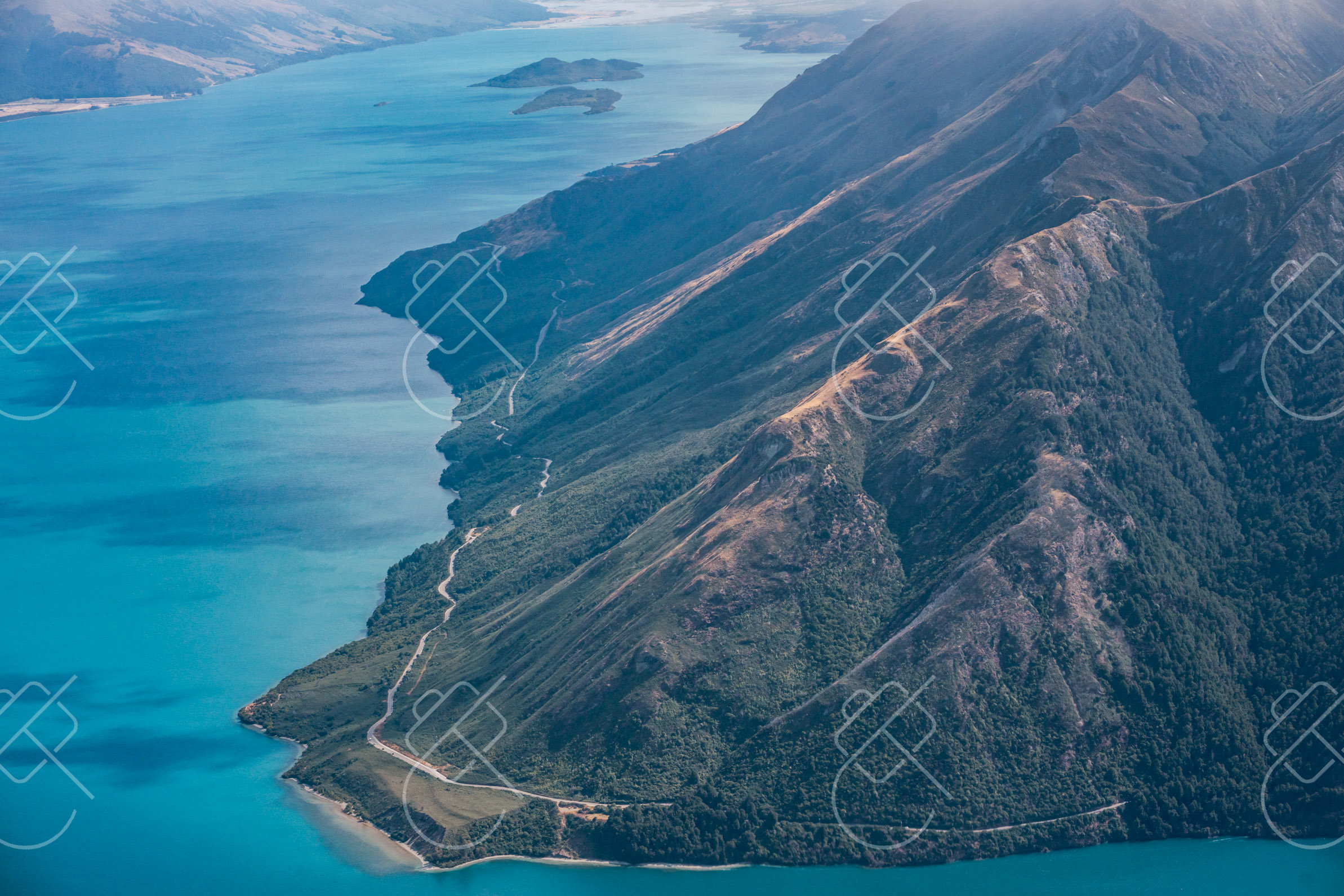
Christchurch is the largest city on the South Island and its main gateway, set on the Canterbury Plains between the Pacific and the Southern Alps. Rebuilt extensively after major earthquakes in 2010 and 2011, it blends restored heritage with bold new architecture and street art.
Often called the Garden City, Christchurch is laid out around the Avon River, which winds through the central Hagley Park and the Botanic Gardens. The earthquakes of 2010-11 destroyed much of the historic center, and the rebuild has produced a distinctive mix: the damaged ChristChurch Cathedral under restoration, the Transitional Cathedral built partly of cardboard tubes, and a thriving program of large-scale murals across the inner city.
The city is the principal arrival point for travelers exploring the South Island, with the TranzAlpine railway crossing the Alps to the West Coast from here. The nearby Banks Peninsula, formed by ancient volcanoes, offers harbor scenery at Akaroa, while the flat Canterbury Plains stretch inland to the foothills of the Alps.
When to go: Late spring to autumn (November–April) brings warm, settled weather and blooming gardens; summer is peak season, while winter is cool and quieter.
Where to stay: The central city near Hagley Park and the Botanic Gardens puts the rebuilt center, river and murals within walking distance.
What to eat: Canterbury lamb, fresh produce from the plains, and seafood including crayfish from the nearby Kaikoura coast.
Tip: The murals are concentrated in the central rebuild zone and reward a walking circuit; soft overcast light avoids glare on the painted walls.
Explore Christchurch →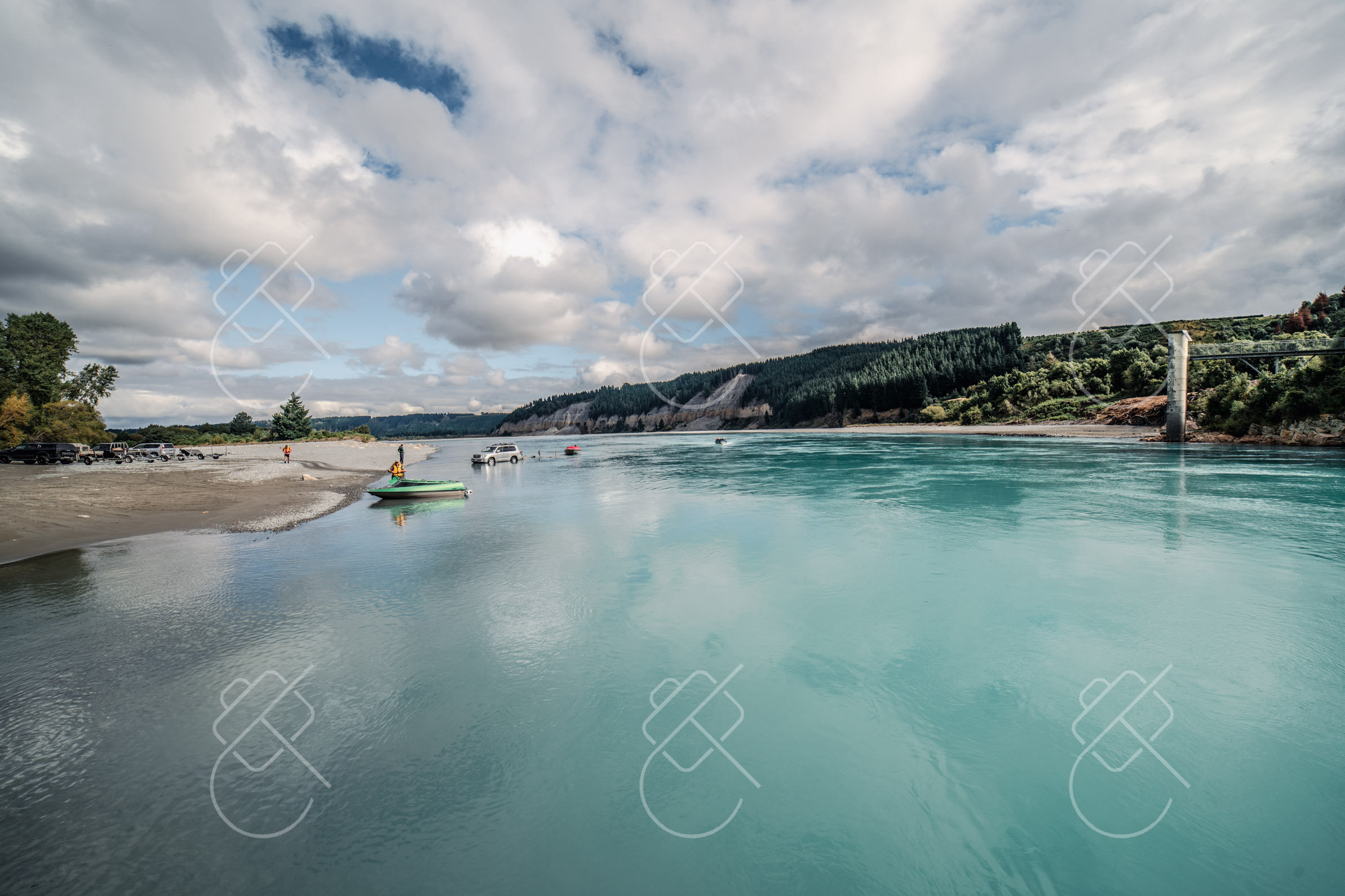
Lake Pukaki is a glacier-fed lake in the Mackenzie Basin whose intense turquoise color comes from finely ground rock flour suspended in its meltwater. At its head rises Aoraki / Mount Cook, the highest mountain in New Zealand.
The lake's vivid milky-blue is the result of glacial flour — rock ground to powder by glaciers and carried down in meltwater, which scatters light to produce the striking color. Fed by the Tasman and other glaciers, Lake Pukaki points directly at Aoraki / Mount Cook, which at 3,724 meters is the country's tallest peak, making the lake's northern shore one of the most photographed viewpoints in New Zealand.
The surrounding Mackenzie Basin is part of an International Dark Sky Reserve, one of the largest in the world, and the area around the lake and nearby Lake Tekapo offers exceptional stargazing and astrophotography. The road up the western shore leads to Aoraki / Mount Cook Village and the Hooker Valley Track, which approaches the mountain past glacier-fed rivers and a terminal lake dotted with icebergs.
When to go: Summer (December–February) for warm weather and clear Aoraki/Mount Cook views; spring and autumn offer fewer crowds and the turquoise lake stays vivid year-round.
Where to stay: Aoraki / Mount Cook Village or the small town of Twizel make practical bases for the lake, the mountain walks and the night skies.
What to eat: Salmon farmed in the cold glacial canals of the Mackenzie is a local specialty, alongside Canterbury lamb.
Tip: The turquoise reads most vividly under direct sun with a polarizing filter, while the dark-sky reserve rewards staying after nightfall for the stars.
Explore Lake Pukaki →
Fox Glacier is one of two glaciers on the West Coast that descend through temperate rainforest to near sea level, an unusual combination of ice and lush green valley. The small township of the same name sits below it, close to a mirror-like reflective lake.
Fox Glacier and the nearby Franz Josef Glacier flow down from the Southern Alps within Te Wahipounamu World Heritage Area, reaching unusually low altitudes for glaciers at this latitude. Heavy West Coast rainfall feeds the snowfields that sustain them, and the valleys they have carved are framed by dense rainforest, giving the rare sight of ice set against subtropical greenery. The glaciers have retreated significantly in recent decades.
A short distance from the township, Lake Matheson is famous for its still, tannin-stained water that on calm mornings reflects Aoraki / Mount Cook and Mount Tasman, the two highest peaks in the country. The lake is ringed by a walking track through native forest, and the reflection viewpoints draw photographers before dawn when the surface is most likely to be mirror-still.
When to go: Spring through autumn (October–April) offers the most stable weather for glacier walks and hikes; summer is busiest, while the region is rainy year-round.
Where to stay: Fox Glacier township is the closest base for both the glacier valley and Lake Matheson, a short drive apart.
What to eat: West Coast whitebait fritters in season, and hearty fare in the township cafés serving glacier visitors.
Tip: The Lake Matheson reflection is best at first light before any breeze disturbs the surface, and the tannin-dark water enhances the mirror effect.
Explore Fox Glacier →See every destination from the 526-day journey:
Browse all destinationsCurious about the gear behind these photos? See the gear list.