Southern Morocco runs from the rose-colored ramparts of Marrakech up over the High Atlas and down into the pre-Sahara, where oasis towns string along dry riverbeds and the road eventually surrenders to sand. It is a region of strong contrasts for the camera: the dense, shadowed lanes of an ancient medina, the ochre geometry of fortified kasbahs, palm groves, and finally the open dunes of Erg Chigaga. Distances are long and the light is intense, so the journey rewards travelers who plan around the soft hours of early morning and late afternoon.
Founded in the 11th century, Marrakech is the largest of Morocco's four imperial cities and the gateway to the south. Its walled medina, a UNESCO World Heritage Site, is built almost entirely of pink-red pisé earth, which gives the city its nickname, the Red City.
The medina is organized around Jemaa el-Fna, a vast square that functions as a market by day and an open-air food and performance ground by night. Radiating from it are the souks, covered lanes grouped by trade, and major monuments including the 12th-century Koutoubia Mosque, whose minaret is the tallest structure in the old city and a fixed reference point on the skyline.
Beyond the square, Marrakech holds a series of enclosed, highly decorated spaces well suited to photography: the carved cedar and stucco of the Ben Youssef Madrasa, the Saadian Tombs, and the cobalt-blue plantings of the Jardin Majorelle. The contrast between the dim, narrow souks and these open courtyards is one of the city's defining visual themes.
When to go: March to May and October to November offer warm, comfortable days for the medina and gardens; summer is brutally hot and winter nights chilly, though winter days stay pleasantly mild.
Where to stay: A traditional riad inside the medina places visitors within walking distance of the souks and Jemaa el-Fna; the Gueliz district offers more modern hotels.
What to eat: Tagine, couscous, harira soup, pastilla, and grilled skewers from the night stalls of Jemaa el-Fna, with mint tea served throughout the day.
Tip: The medina lanes are narrow and disorienting; mornings are quieter and the low sun reaches into the souks, making it the best window for unobstructed photographs.
Explore Marrakech →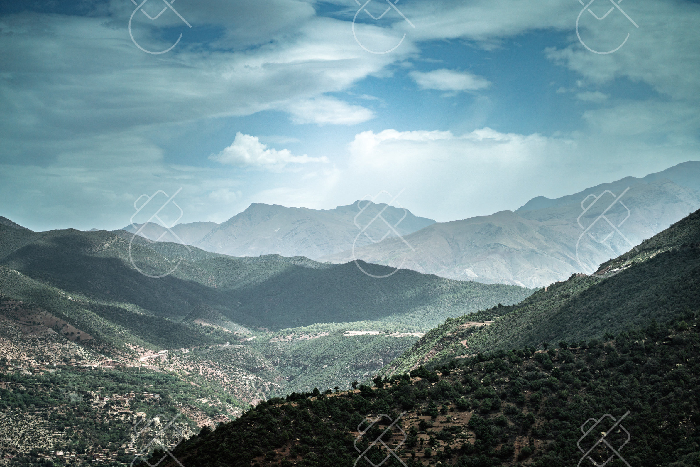
Set south of the High Atlas on the edge of the desert, Ouarzazate is a quiet provincial town that has become a center of Moroccan and international filmmaking, earning it the name Ouallywood. It serves as a base for visiting the surrounding kasbahs and oasis valleys.
The town's reputation rests on its film studios, including Atlas Studios and CLA Studios, where standing sets built for historical and biblical productions can be visited. The surrounding landscape of bare mountains and earthen architecture has stood in for many other places on screen.
Just outside town stands the Kasbah Taourirt, a large earthen fortress once associated with the Glaoui family, and a short drive away is Aït Benhaddou, a fortified village of stacked kasbahs that is a UNESCO World Heritage Site and one of the most photographed structures in Morocco.
When to go: Spring and autumn are ideal for exploring the kasbahs and film studios in comfortable temperatures; the desert-edge town swings between scorching summers and cold winter nights.
Where to stay: Ouarzazate has a range of hotels and kasbah-style guesthouses; staying near Aït Benhaddou allows for sunrise photography of the ksar.
What to eat: Hearty Berber tagines, dates from the surrounding oases, and bread baked in communal ovens.
Tip: Aït Benhaddou photographs best from across the riverbed in early morning, when the rising sun lights the kasbah walls and the village is less crowded.
Explore Ouarzazate →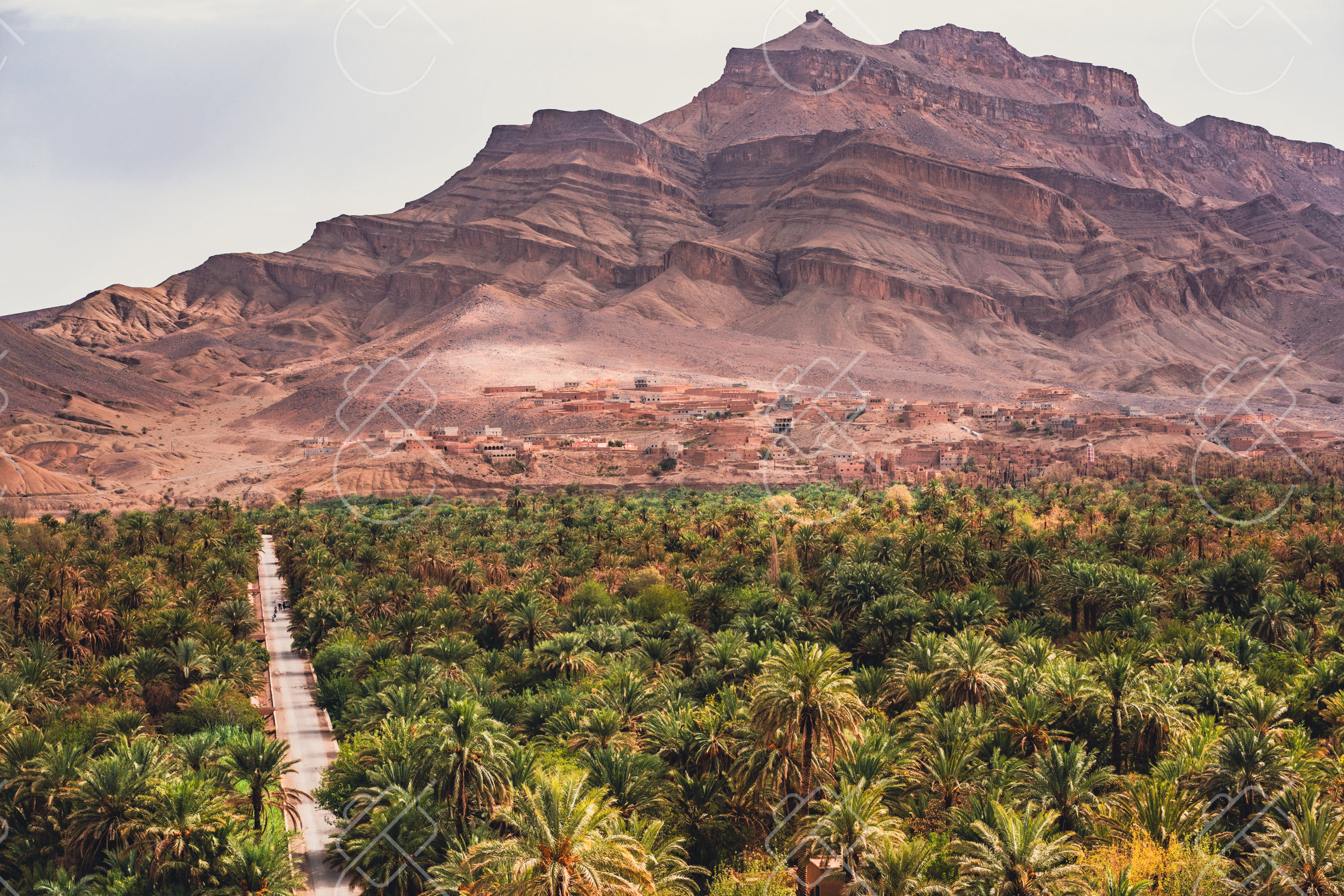
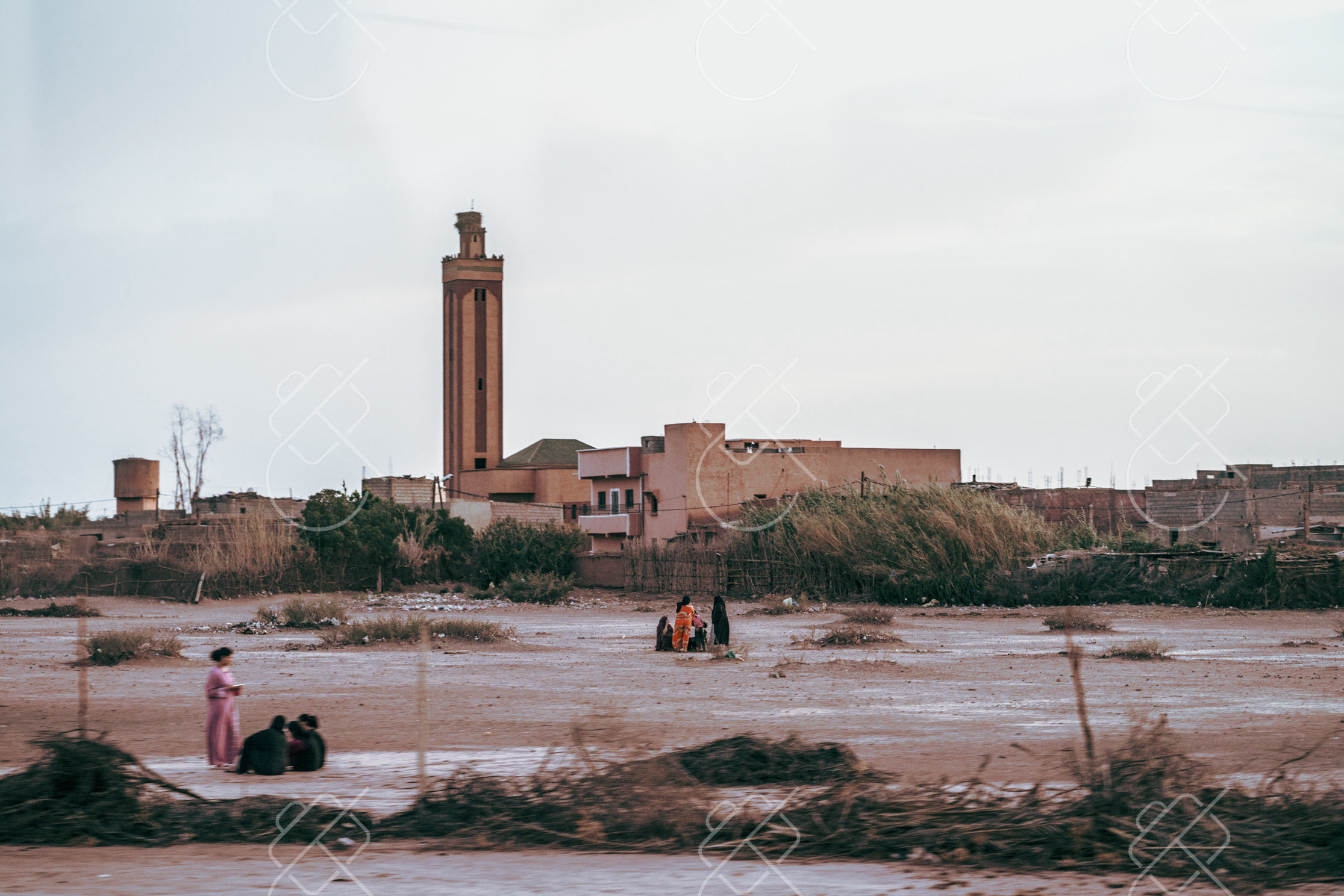
Zagora sits in the Draa Valley, a long oasis corridor of date palms following the Draa River toward the desert. It is a traditional staging point for camel treks and journeys deeper into the Sahara.
The town is best known for a much-photographed road sign reading Tombouctou 52 jours, a reference to the historic camel-caravan route to Timbuktu that once passed through the region. Around Zagora, the Draa Valley is thick with palm groves and small kasbahs built of mud brick.
Above the town rises Jebel Zagora, a hill offering panoramic views over the palmeraie and the river. The valley's combination of green oasis and surrounding desert hills makes it a transitional landscape between the cultivated south and the open Sahara.
When to go: October to April brings bearable daytime heat for this gateway to the dunes; avoid the punishing summer, when desert temperatures soar well past comfort.
Where to stay: Zagora has simple hotels and palmeraie guesthouses, and is a common departure point for overnight stays in desert camps.
What to eat: Dates from the Draa Valley, tagines, and bread cooked over wood fires at desert camps.
Tip: Climb Jebel Zagora before sunrise to photograph the palm groves emerging from shadow as the sun clears the surrounding hills.
Explore Zagora →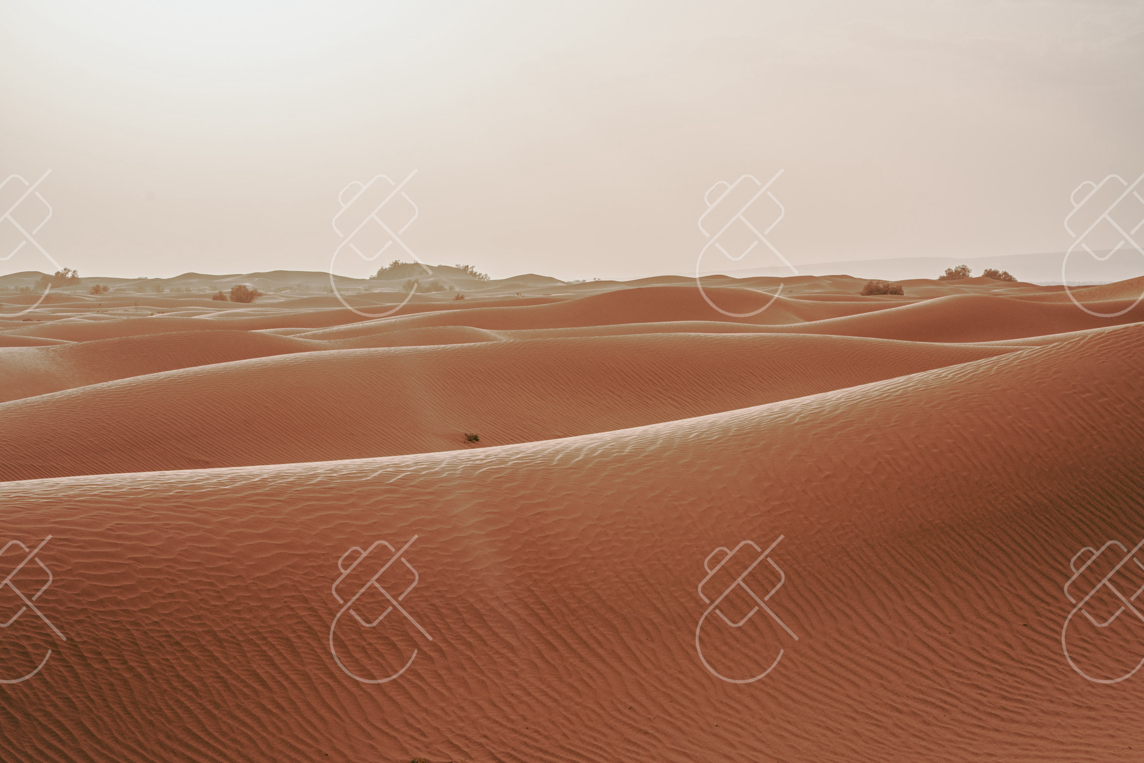
Erg Chigaga is the largest and most remote field of Saharan dunes accessible from southern Morocco, reached by a long off-road drive beyond the end of the paved road at M'Hamid. Its isolation keeps it far quieter than Morocco's more visited dune fields.
The erg stretches roughly 40 kilometers and rises to dunes of around 300 meters, forming a broad sea of sand without nearby towns or roads. Access requires a four-wheel-drive vehicle, and most visitors stay in tented desert camps set among the dunes.
Because it is far from settlements, Erg Chigaga offers exceptionally dark skies for night photography and uninterrupted dune horizons. The combination of remoteness, scale and clean light makes it a primary destination for landscape and astrophotography in the Moroccan Sahara.
When to go: Visit October through April for tolerable daytime warmth and cool, star-filled nights ideal for desert camping; summer heat in the dunes is dangerous and best avoided entirely.
Where to stay: Tented desert camps among the dunes, ranging from basic to comfortable, reached by four-wheel-drive from M'Hamid or Zagora.
What to eat: Camp meals of tagine and bread cooked on site, with tea prepared over open fires.
Tip: The first and last light of day reveal the strongest ridgelines and shadow patterns across the dunes, so position camps with morning views in mind.
Explore Erg Chigaga →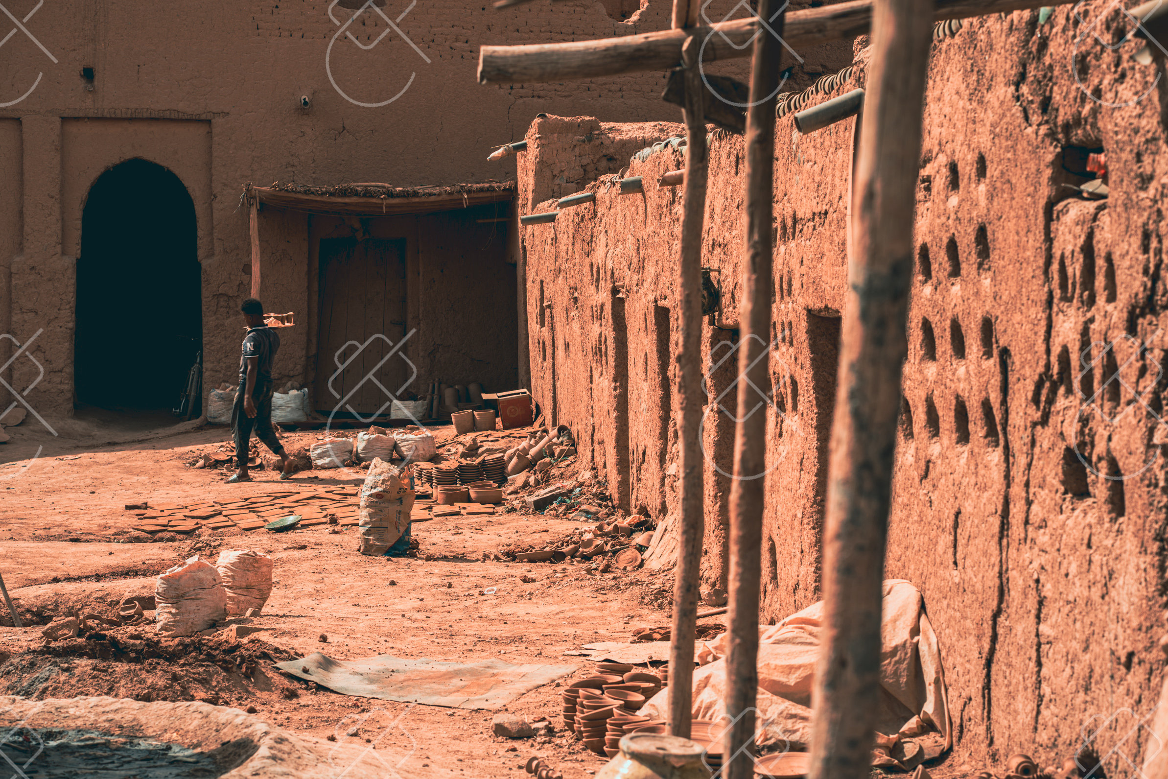
Tamgroute is a small town in the lower Draa Valley known for two things: a centuries-old religious library and a tradition of distinctive green-glazed pottery. It offers a focused, lesser-visited stop between Zagora and the desert.
The town grew around the Zaouia Naciria, a religious complex and Sufi center whose library preserves a collection of antique manuscripts, including illuminated Qurans and works on science and law. The zaouia long served as a place of learning and pilgrimage in the region.
Tamgroute is also a center for green pottery, fired in communal underground kilns and finished with a copper-derived glaze that gives the wares their characteristic green tone. The potters' quarter, with its stacked ceramics and earthen workshops, is a compact and colorful subject for photography.
When to go: Spring and autumn offer the most comfortable conditions to visit the ancient library and green-pottery kilns; like the wider Draa Valley, summers are intensely hot.
Where to stay: Most visitors base themselves in nearby Zagora; Tamgroute itself has a few small guesthouses near the zaouia.
What to eat: Local Draa Valley dishes, dates, and mint tea served in the workshops and guesthouses.
Tip: The pottery workshops catch warm, raking light in late afternoon, which deepens the green glaze and the texture of the earthen kilns.
Explore Tamgroute →See every destination from the 526-day journey:
Browse all destinationsCurious about the gear behind these photos? See the gear list.